Overview
A Landscape and Visual Impact Assessment (LVIA) is being prepared by Shanti McAllister Landscape Planning & Design Ltd, an independent consultant and Chartered Landscape Architect with 23 years’ experience preparing LVIAs for wind farms in Northern Ireland.
LVIA is a formal part of the Environmental Impact Assessment (EIA) process, and the methodology used is in accordance with best practice guidance publications relating both to the LVIA process in general and in specific relation to wind farm developments.
The objectives of an LVIA are to:
- Present an objective analysis of the landscape and visual character of a defined area (the ‘Study Area’) in so far as they relate to the Development. The Study Area for this LVIA covers an area that extends to a 30 km radius from the Development;
- Identify the potential effects of the Development on these baseline conditions including direct, indirect, permanent, temporary and cumulative effects;
- Clearly distinguish between landscape effects – the effects on the physical landscape as a resource in its own right – and visual effects – the effects on specific views and general visual amenity as experienced by people;
- Propose appropriate mitigation measures to address likely significant effects, where possible, and to assess any residual effects that remain following the implementation of these measures;
- Present all information clearly and objectively in a manner that will inform the decision-making process.
Viewpoint Selection
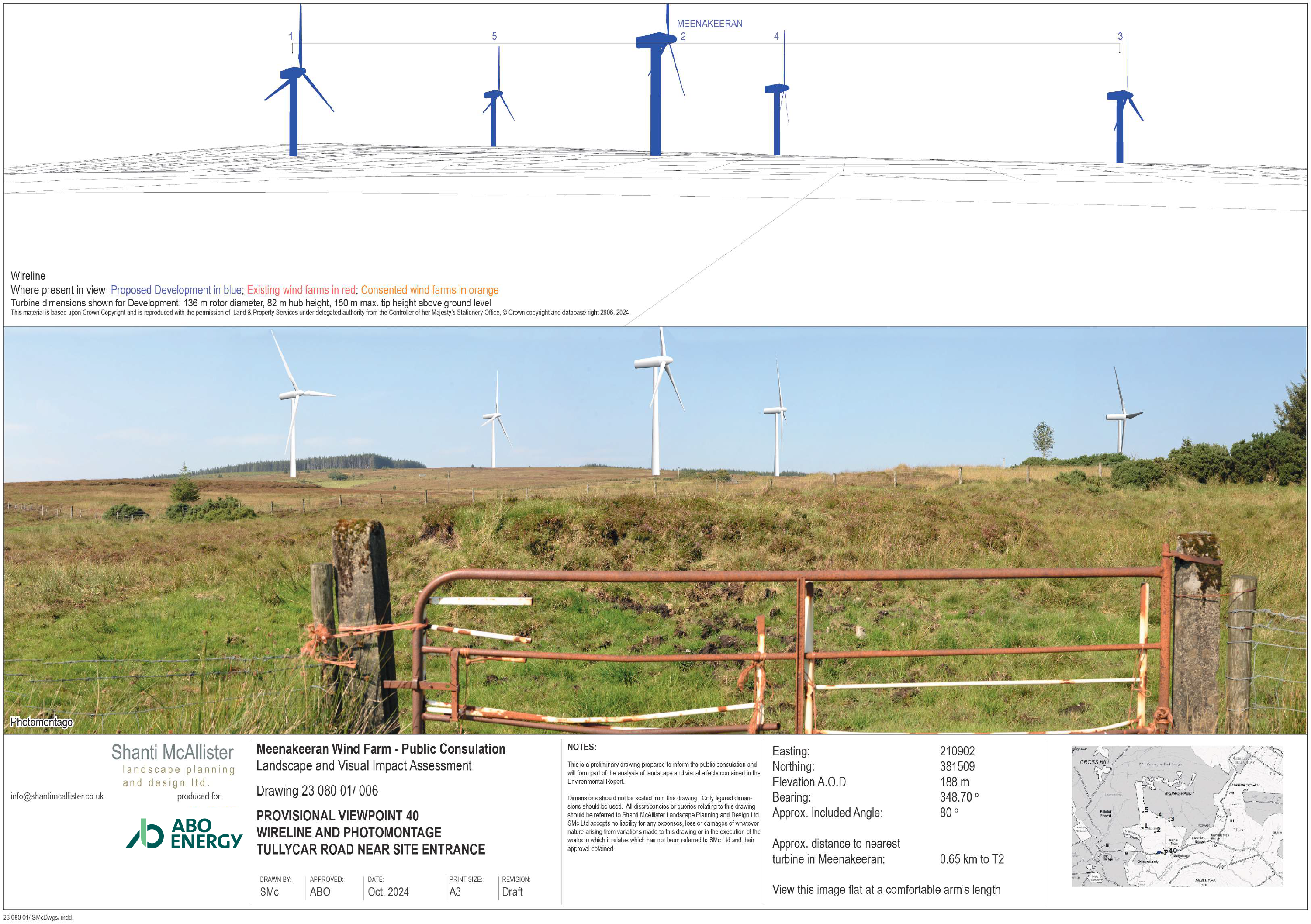
Viewpoints are chosen to provide a representative sample of viewers (visual receptors) and types of views of the Development across the Study Area and, most importantly, to demonstrate potential views of the Development rather than to show the screening effect of landscape features.
Viewpoints are always selected in publicly accessible locations and those frequented by members of the public, such as rights of way, car parks, popular visitor attractions and views from settlements, as well as viewpoints located in particularly scenic areas because these are likely to represent a greater concentration of sensitive visual receptors. Viewpoints from which the Development is likely to be prominent are also favoured if they are available.
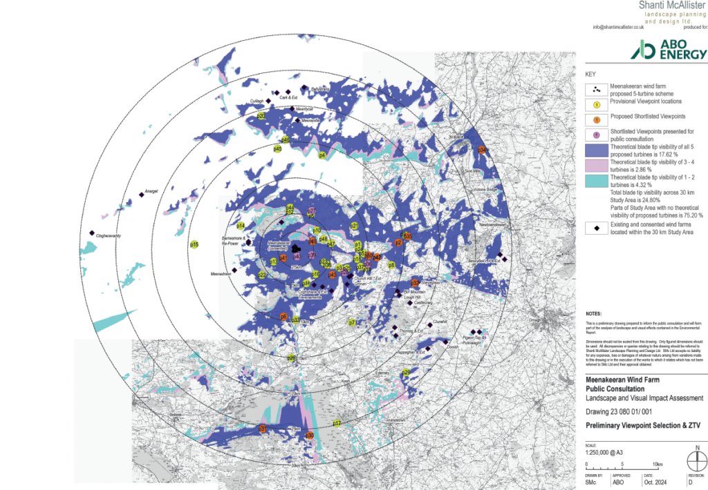
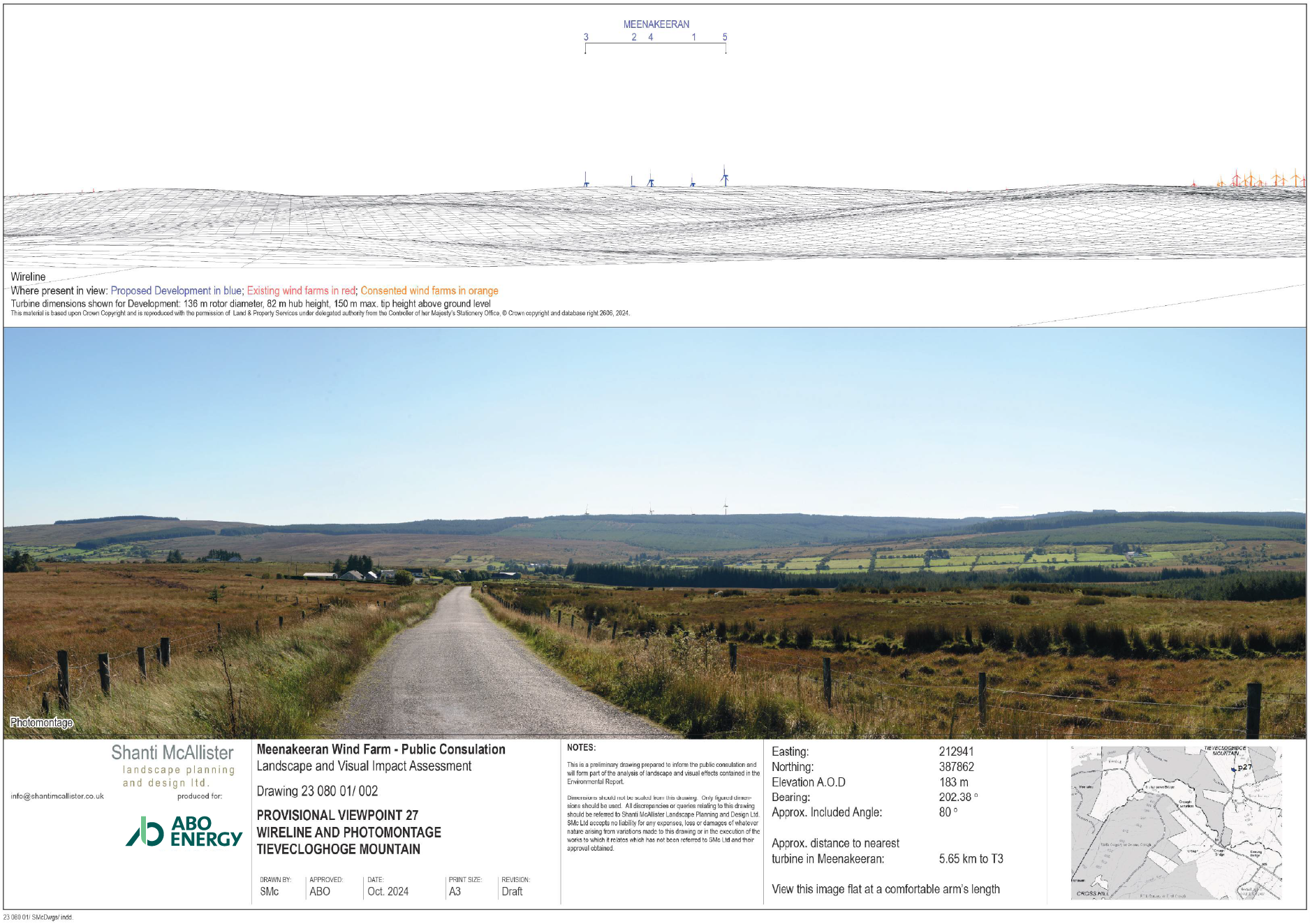
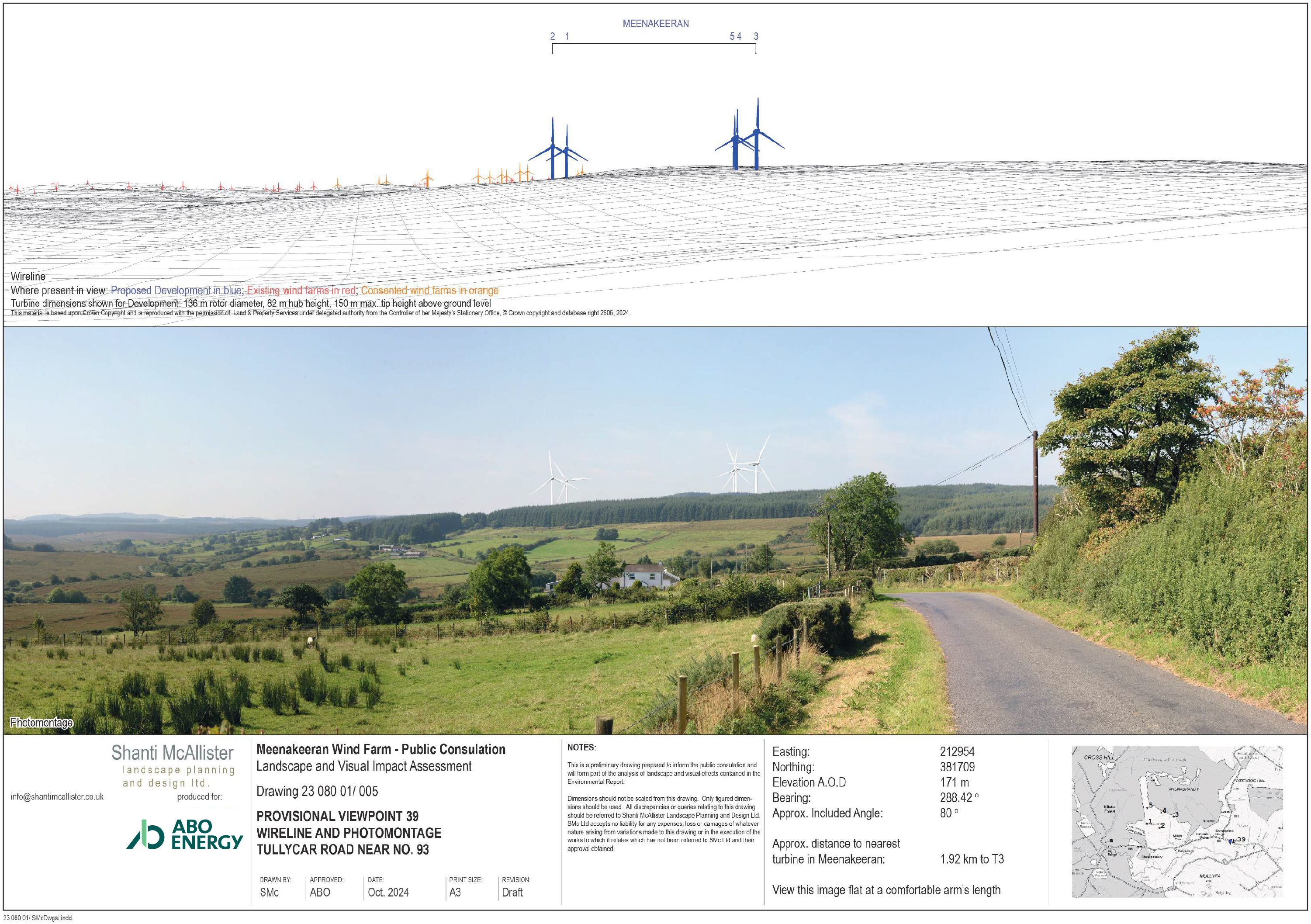
Private residential views are represented where possible by the selection of appropriate viewpoints on public roads in proximity to residential receptors. This is in accordance with current best practice guidance. Using these search criteria, 51 Provisional Viewpoints (PVPs) were analysed and shortlisted to a proposed selection of 17 Viewpoints which will be presented in the ES. A selection of the shortlisted viewpoint locations is presented in this exhibition. Although the views chosen are representative, they cannot always be typical of the whole Study Area.
Zone of Theoretical Visibility Diagrams:
A Zone of Theoretical Visibility (ZTV) is a map-based diagram showing where the Development would theoretically be visible from within the Study Area. It is created using computer-generated contour data and are useful in providing an initial indication of visibility within the Study Area that allows for more detailed assessment in the field. They do not illustrate actual visibility because they do not take account of aboveground features such as vegetation or buildings, or contour variations between 50 m intervals.
ZTV diagrams are based on the visibility of either the turbine blade tips or hub heights. Blade tip visibility means that any area where the tip of the blade is theoretically visible is indicated on the diagram. Hub height visibility means that any area from the turbine hub upwards to the blade tip is shown. A Reverse ZTV diagram is used as a clear means of illustrating the parts of the Study Area where no turbines would be visible.
Photomontages
Viewpoints are chosen to provide a representative sample of viewers (visual receptors) and types of views of the Development across the Study Area and, most importantly, to demonstrate potential views of the Development rather than to show the screening effect of landscape features.
Viewpoints are always selected in publicly accessible locations and those frequented by members of the public, such as rights of way, car parks, popular visitor attractions and views from settlements, as well as viewpoints located in particularly scenic areas because these are likely to represent a greater concentration of sensitive visual receptors. Viewpoints from which the Development is likely to be prominent are also favoured if they are available.
Private residential views are represented where possible by the selection of appropriate viewpoints on public roads in proximity to residential receptors. This is in accordance with current best practice guidance. Using these search criteria, 51 Provisional Viewpoints (PVPs) were analysed and shortlisted to a proposed selection of 17 Viewpoints which will be presented in the ES. A selection of the shortlisted viewpoint locations is presented in this exhibition. Although the views chosen are representative, they cannot always be typical of the whole Study Area.

